A Printable Blank Oceania Map is one of the most versatile tools for learning and creative exploration. Whether you are a student studying world geography, a teacher preparing classroom materials, a traveler planning your next adventure, or a designer working on a project, an outline map of Oceania offers a clean and flexible foundation. With no labels or markings, it allows complete customization, making it ideal for a wide range of uses.
A transparent PNG version adds even more flexibility, allowing users to overlay the map onto other designs, presentations, or digital projects without background interference.
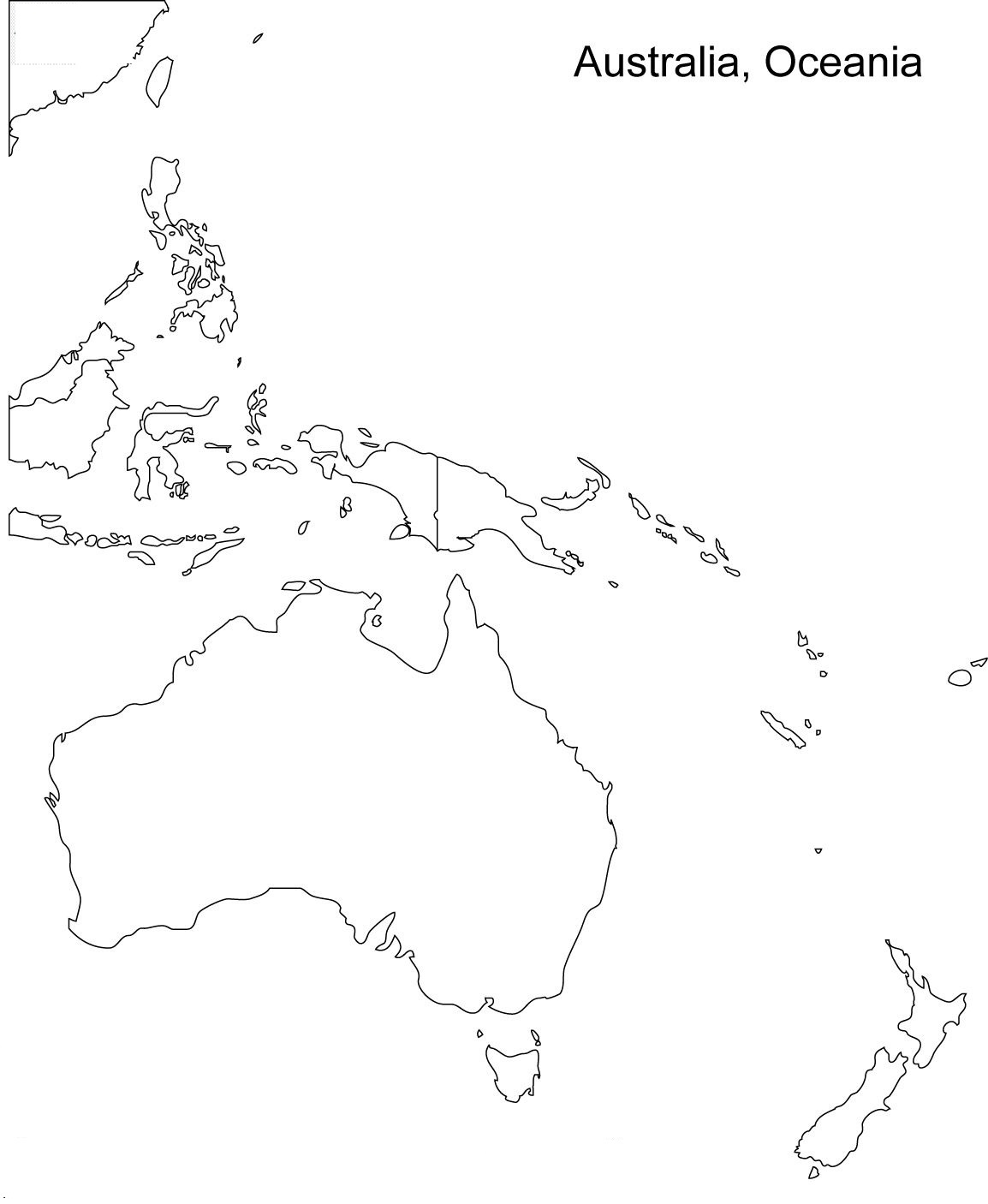
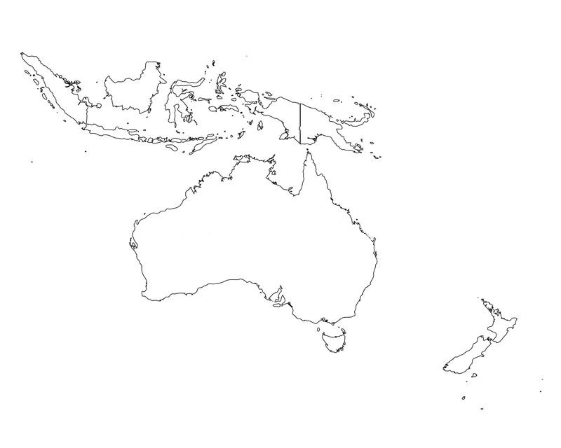
Blank Oceania Map
One of the biggest advantages of a blank Oceania map is its educational value. Students can use it to label countries, capitals, and major geographic features. This hands-on activity improves memory retention and helps build a stronger understanding of the region.
Teachers often rely on these maps for quizzes, assignments, and classroom exercises because they encourage active participation rather than passive learning. Instead of simply reading about locations, students engage directly with the material by filling in the map themselves.
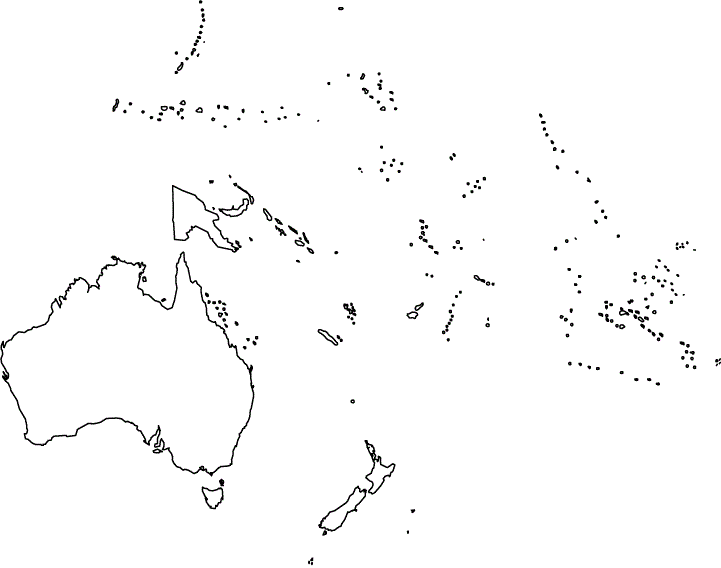
Oceania is a vast and diverse region that includes countries such as Australia, New Zealand, Papua New Guinea, and thousands of islands scattered across the Pacific Ocean. Because of its unique geographic layout, having a blank map is especially useful for understanding spatial relationships, island groupings, and regional divisions.
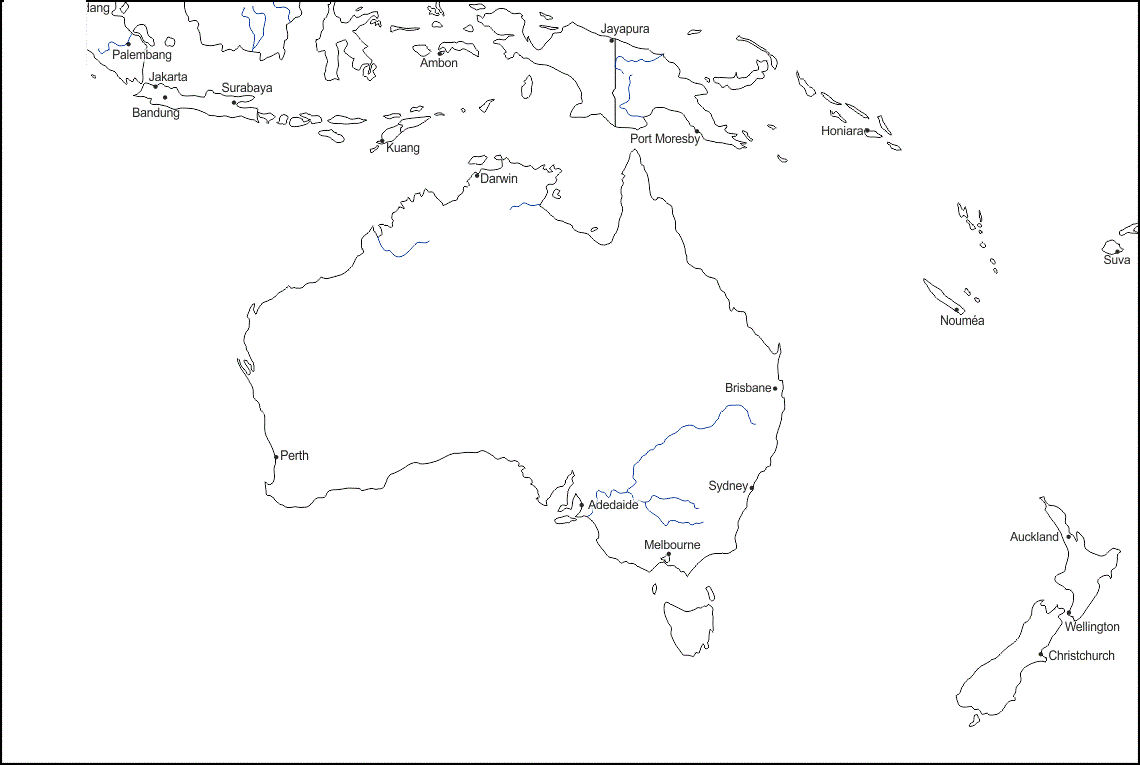
Printable Map of Oceania
Printable maps are particularly convenient because they can be used offline and shared easily. You can print multiple copies for classroom use or personal study sessions. They are also cost-effective, as many blank maps are available for free or at minimal cost. Once printed, they can be reused in various ways, such as coloring activities, labeling exercises, or even as part of interactive games.
The outline format is especially important for clarity. A simple black-and-white outline removes distractions and focuses attention on the geographic shapes and boundaries. This minimalist design is ideal for educational purposes, as it allows users to add their own information without clutter. For example, students can color-code different countries, mark important cities, or highlight specific regions like Melanesia, Micronesia, and Polynesia.
- Exploring a Blank Map of Brazil
- Printable Blank World Map
- Blank World Map With Continents
- Printable Labeled Map of Asia
- Printable Blank Iran Map
- Blank Strait of Hormuz Map
- Bab el-Mandeb Strait Map
Transparent PNG Oceania Map
Transparent PNG maps take usability to the next level. Unlike standard images with a solid background, a transparent PNG allows the map to blend seamlessly into any project. This is particularly useful for digital presentations, website design, and graphic projects. For instance, you can place the map over a colored background, combine it with text and icons, or integrate it into an infographic without worrying about unwanted borders or backgrounds.
Another key benefit of using a blank Oceania map is its role in travel planning. If you are preparing for a trip to the Pacific region, you can use the map to mark destinations, routes, and points of interest. This visual planning method makes it easier to understand distances and connections between islands, which can be challenging due to the vastness of the ocean. It also helps travelers gain a better appreciation of the region’s geography before they arrive.
For homeschooling parents, a printable blank Oceania map can be an excellent addition to the curriculum. It encourages interactive learning and can be adapted for different age groups. Younger children can use it for coloring and basic identification, while older students can explore more advanced topics such as climate zones, cultural regions, and economic activities. This flexibility makes it a valuable tool for personalized education.
Map of Oceania For Practice Worksheet
Another important aspect is its usefulness in exams and competitive tests. Many geography exams require students to identify locations on a blank map. Practicing with a printable Oceania map helps improve accuracy and confidence. By repeatedly labeling and reviewing the map, students can develop a strong mental image of the region, which is crucial for performing well in tests.
When choosing a blank Oceania map, it is important to look for high resolution and clear outlines. A map ensures that details remain sharp even when printed or zoomed in. This is especially important for larger prints or detailed labeling tasks. A well-designed map should accurately represent the region’s geography while maintaining simplicity and clarity.
Blank Oceania Map Outline
In creative projects, blank maps can be used in unique ways. For example, you can create a themed map highlighting biodiversity, cultural diversity, or historical events. You can also use it as a base for storytelling, where each island or country represents a different part of a narrative. This makes the map not just an educational tool but also a creative medium.
The versatility of a printable blank Oceania map makes it a valuable resource across multiple fields. From classrooms and homes to offices and design studios, it serves as a foundation for learning, planning, and creativity. Its simplicity is its greatest strength, allowing users to adapt it to their specific needs without ограничения.
FAQs
What is a printable blank Oceania map?
A printable blank Oceania map is an outline map of the Oceania region without labels, designed for printing and customization. It typically shows country boundaries and geographic shapes.
Is a blank Oceania Map useful For Students?
Yes, it is highly useful for students as it helps them learn geography through active participation, such as labeling, coloring, and identifying locations.
Can I use these Maps For Commercial Projects?
It depends on the source of the map. Always check the licensing terms before using it for commercial purposes to ensure compliance.
How can Teachers use Blank Maps in Classrooms?
Teachers can use them for quizzes, assignments, group activities, and interactive lessons to enhance student engagement and understanding.
What Format is Best For Printing?
High-resolution PNG or PDF formats are best for printing, as they ensure clarity and sharp outlines.
Are these maps suitable for travel planning?
Yes, travelers can use them to mark destinations, routes, and important locations, making trip planning more visual and organized.
Can I edit a blank Oceania map digitally?
Yes, you can edit PNG maps using graphic design software to add labels, colors, and other elements according to your needs.
Where can I find high-quality blank Oceania maps?
You can find them on educational websites, map resource platforms, and design repositories that offer free or paid downloads.
How do I make learning more interactive with these maps?
You can turn map activities into games, quizzes, or creative projects like storytelling and thematic mapping to make learning more engaging.